Woolwich, SE18
Introduction
The photograph on this page of Woolwich, SE18 by David Hallam-Jones as part of the Geograph project.
The Geograph project started in 2005 with the aim of publishing, organising and preserving representative images for every square kilometre of Great Britain, Ireland and the Isle of Man.

There are currently over 7.5m images from over 14,400 individuals and you can help contribute to the project by visiting https://www.geograph.org.uk
Woolwich, SE18
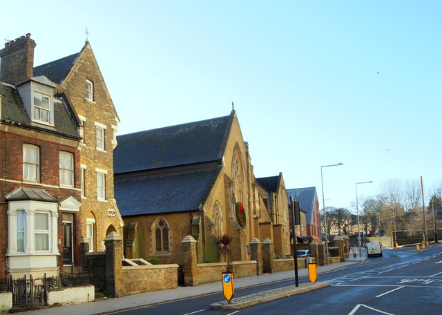
Image: © David Hallam-Jones Taken: 1 Jan 2013
Looking out onto the junction formed by Woolwich New Road (on which the van is parked) and Grand Depot Road are the Presbytery, the Roman Catholic Church of St Peter the Apostle and a former Roman Catholic School (now a Church Centre). The church is a Grade II-listed building that was designed by Augustus W.N.Pugin in 1843. The main shopping centre is on the left, whilst Woolwich Barracks is reached by Woolwich New Road using the One Way system in place.
Images are licensed for reuse under creativecommons.org/licenses/by-sa/2.0
Image Location
Latitude
51.488487
Longitude
0.066623