Woolwich Common Area, SE18
Introduction
The photograph on this page of Woolwich Common Area, SE18 by David Hallam-Jones as part of the Geograph project.
The Geograph project started in 2005 with the aim of publishing, organising and preserving representative images for every square kilometre of Great Britain, Ireland and the Isle of Man.

There are currently over 7.5m images from over 14,400 individuals and you can help contribute to the project by visiting https://www.geograph.org.uk
Woolwich Common Area, SE18
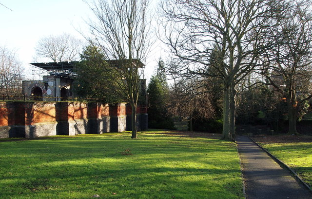
Image: © David Hallam-Jones Taken: 1 Jan 2013
This path connects Woolwich New Rd (ahead) and Grand Depot Road/A205 (at the rear) and runs along the south side of the ruins of the Garrison Chapel of St George. The church was commissioned by the Secretary of State for War in 1683 but ceased to be operational in 1944 following a hit by a V1 flying bomb. Apart from a "temporary" roof, fitted in the 70s, it appears to have been left relatively untouched although the grounds appear cared for. The Heritage of London Trust is apparently in discussion with the Defence Infrastructure Organisation (DIO) about replacing the “temporary” roof and restoring its damaged mosaics and a local management committee hopes eventually to encourage its use for concerts and other events. The Woolwich Barracks parade ground lies behind the photographer.
Images are licensed for reuse under creativecommons.org/licenses/by-sa/2.0
Image Location
Latitude
51.485138
Longitude
0.062727