Woolwich Common Area, SE18
Introduction
The photograph on this page of Woolwich Common Area, SE18 by David Hallam-Jones as part of the Geograph project.
The Geograph project started in 2005 with the aim of publishing, organising and preserving representative images for every square kilometre of Great Britain, Ireland and the Isle of Man.

There are currently over 7.5m images from over 14,400 individuals and you can help contribute to the project by visiting https://www.geograph.org.uk
Woolwich Common Area, SE18
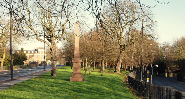
Image: © David Hallam-Jones Taken: 1 Jan 2013
This wedge-shaped plot of land hosts two military related monuments. In the foreground is this Boer War memorial to the Officers and Men of the 61st Battery of the Royal Field Artillery who died in South Africa between 1899-1902 and behind it, albeit hidden by the trees, the ruins of St George's Garrison Church. The church was built in the 1860s to serve the Royal Artillery Barracks, part of which is visible on the left hand side of the picture. The right-hand road is Woolwich New Rd, that joins Grand Depot Rd (the A205) behind the photographer. Both roads connect Woolwich Common and Woolwich Arsenal.
Images are licensed for reuse under creativecommons.org/licenses/by-sa/2.0
Image Location
Latitude
51.484067
Longitude
0.062246