Milton Lock
Introduction
The photograph on this page of Milton Lock by Simon Carey as part of the Geograph project.
The Geograph project started in 2005 with the aim of publishing, organising and preserving representative images for every square kilometre of Great Britain, Ireland and the Isle of Man.

There are currently over 7.5m images from over 14,400 individuals and you can help contribute to the project by visiting https://www.geograph.org.uk
Milton Lock
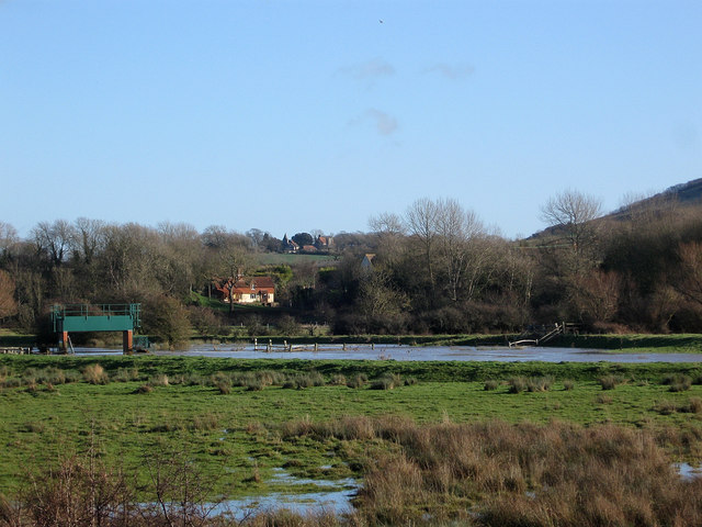
Image: © Simon Carey Taken: 1 Jan 2013
Sluice gates on the Cuckmere River located at the highest point tides reach. The wooded area to the right is The Rookery which contains earthworks of a possible medieval motte and bailey. Visible through the gap in the trees are Burlow Cottages and above them further in the distance is Wilmington Church.
Images are licensed for reuse under creativecommons.org/licenses/by-sa/2.0
Image Location
Latitude
50.815632
Longitude
0.164688