Building the village shop, Highfields
Introduction
The photograph on this page of Building the village shop, Highfields by David Gruar as part of the Geograph project.
The Geograph project started in 2005 with the aim of publishing, organising and preserving representative images for every square kilometre of Great Britain, Ireland and the Isle of Man.

There are currently over 7.5m images from over 14,400 individuals and you can help contribute to the project by visiting https://www.geograph.org.uk
Building the village shop, Highfields
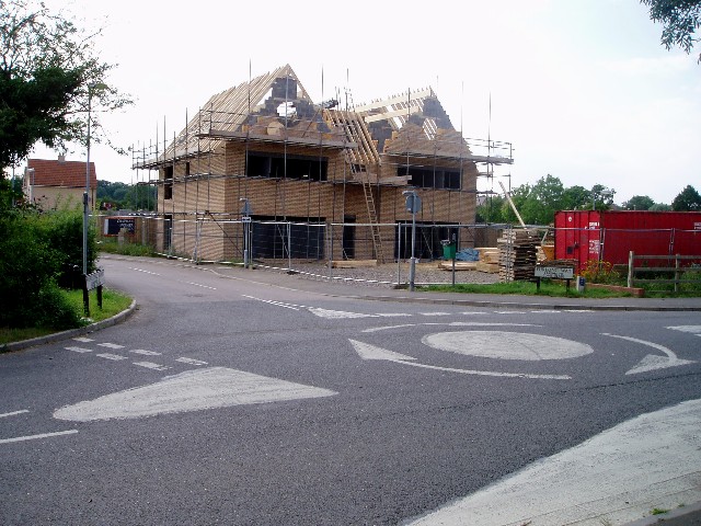
Image: © David Gruar Taken: 2 Aug 2005
Highfields (also known as Highfields Caldecote - the old village of Caldecote is a mile to the south) is a rapidly expanding community. At the time the photo was taken the village had just undergone a major development that had seen its population treble; only then did the developers start to build the village shop, saving the residents a drive of several miles. The road through the village has 14 notoriously vicious speed bumps; the mini roundabout is also part of the traffic 'calming' measures.
Images are licensed for reuse under creativecommons.org/licenses/by-sa/2.0
Image Location


Leaflet Map data © OpenStreetMap
Latitude
52.208071
Longitude
-0.018407