Kiltarlity war memorial
Introduction
The photograph on this page of Kiltarlity war memorial by Craig Wallace as part of the Geograph project.
The Geograph project started in 2005 with the aim of publishing, organising and preserving representative images for every square kilometre of Great Britain, Ireland and the Isle of Man.

There are currently over 7.5m images from over 14,400 individuals and you can help contribute to the project by visiting https://www.geograph.org.uk
Kiltarlity war memorial
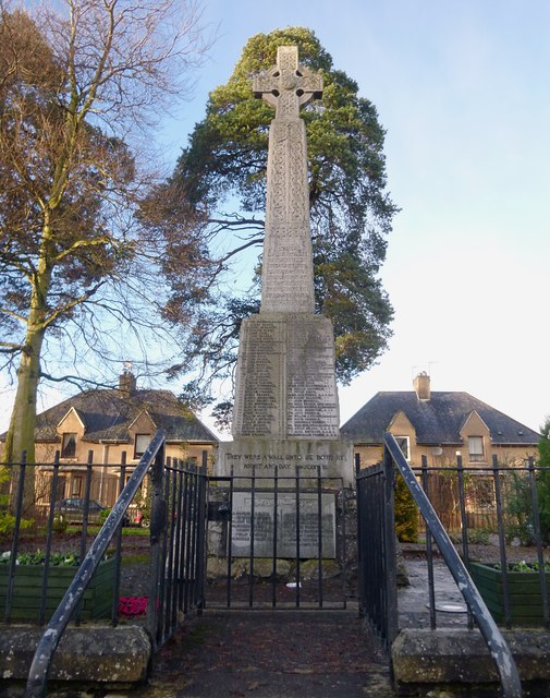
Image: © Craig Wallace Taken: 1 Jan 2013
In memory of the men of the parish of Kiltarlity, who were killed in the first and second world wars. The memorial is a granite Celtic cross, similar to several other local memorials. It was unveiled by Lord Lovat in 1922. Some more details on the War Memorials Archive: http://www.ukniwm.org.uk/server/show/conMemorial.57670/ The memorial is next to the main road through the village. Several houses on Pine Road are behind it.
Images are licensed for reuse under creativecommons.org/licenses/by-sa/2.0
Image Location
Latitude
57.440747
Longitude
-4.488082