The Street, Ash from St Nicholas' churchyard
Introduction
The photograph on this page of The Street, Ash from St Nicholas' churchyard by John Baker as part of the Geograph project.
The Geograph project started in 2005 with the aim of publishing, organising and preserving representative images for every square kilometre of Great Britain, Ireland and the Isle of Man.

There are currently over 7.5m images from over 14,400 individuals and you can help contribute to the project by visiting https://www.geograph.org.uk
The Street, Ash from St Nicholas' churchyard
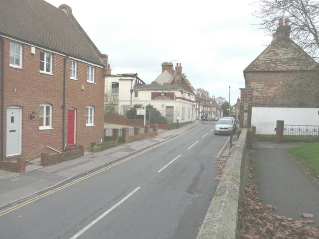
Image: © John Baker Taken: 30 Dec 2012
On the left is the former Lagaan Restaurant (number 60) that was gutted by fire on 17 January 2009 as reported in these links http://www.thisiskent.co.uk/Investigation-Indian-restaurant/story-12000873-detail/story.html and http://news.bbc.co.uk/1/hi/england/kent/7835051.stm It is now to be rebuilt. Planning permission has been granted by Dover District Council under application number DOV/12/00678 for “change of use, conversion and rebuilding of existing building to form two semi-detached dwellings and creation of a detached car port”.
Images are licensed for reuse under creativecommons.org/licenses/by-sa/2.0
Image Location
Latitude
51.278854
Longitude
1.279568