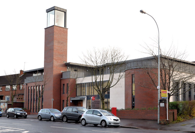
Belfast South Methodist church (Lisburn Road)
Introduction
The photograph on this page of Belfast South Methodist church (Lisburn Road) by Albert Bridge as part of the Geograph project.
The Geograph project started in 2005 with the aim of publishing, organising and preserving representative images for every square kilometre of Great Britain, Ireland and the Isle of Man.
There are currently over 7.5m images from over 14,400 individuals and you can help contribute to the project by visiting https://www.geograph.org.uk

Image: © Albert Bridge Taken: 30 Dec 2012
See Image (March 2008) and Image (February 2011). This is the replacement building. It also includes the “Agape Centre” “partnership networking centre to enable collaboration and resource sharing among the statutory, voluntary and community sectors. No such facility presently exists. This centre will provide a visible, co-ordinating focal point for a range of specific services to the diverse local community of south Belfast. We plan to build on emerging relationships, to foster new ones, all with the idea of increased social cohesion. The building will provide accommodation and services to a multiplicity of users, including ethnic minorities, parents, young people, children, the elderly and other disadvantaged groups”. Architects Kennedy Fitzgerald.

