Horley: Former fire station
Introduction
The photograph on this page of Horley: Former fire station by Nigel Cox as part of the Geograph project.
The Geograph project started in 2005 with the aim of publishing, organising and preserving representative images for every square kilometre of Great Britain, Ireland and the Isle of Man.

There are currently over 7.5m images from over 14,400 individuals and you can help contribute to the project by visiting https://www.geograph.org.uk
Horley: Former fire station
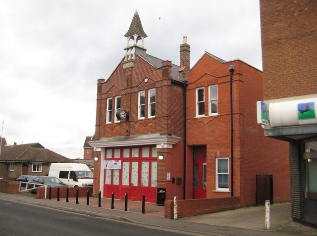
Image: © Nigel Cox Taken: 9 Dec 2012
Please see Richard's Image] for a view in 2006 prior to the extension on the right being built, and Ian's Image] for a view in 2011 and a good history of the building. In each image the clock is resolutely stopped at 1:46! The letters HPC are carved into the stone tablet underneath the cupola, possibly standing for Horley Parish Council who might have had responsibility for the fire service in the early 1900s?
Images are licensed for reuse under creativecommons.org/licenses/by-sa/2.0
Image Location
Latitude
51.172621
Longitude
-0.163261