Boxhill & Westhumble station, 1990
Introduction
The photograph on this page of Boxhill & Westhumble station, 1990 by Ben Brooksbank as part of the Geograph project.
The Geograph project started in 2005 with the aim of publishing, organising and preserving representative images for every square kilometre of Great Britain, Ireland and the Isle of Man.

There are currently over 7.5m images from over 14,400 individuals and you can help contribute to the project by visiting https://www.geograph.org.uk
Boxhill & Westhumble station, 1990
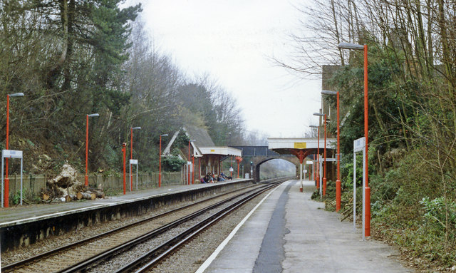
Image: © Ben Brooksbank Taken: 11 Mar 1990
View northward, towards London: ex-LBSCR London - Sutton - Dorking North - Horsham - South Coast/Portsmouth line. This was just after the Great Storm of 25 January 1990 and on the left can be seen the remains of a tree that fell on the Up side.
Images are licensed for reuse under creativecommons.org/licenses/by-sa/2.0
Image Location
Latitude
51.254156
Longitude
-0.329259