Approaching site of Bower station on line from Wick, 1986
Introduction
The photograph on this page of Approaching site of Bower station on line from Wick, 1986 by Ben Brooksbank as part of the Geograph project.
The Geograph project started in 2005 with the aim of publishing, organising and preserving representative images for every square kilometre of Great Britain, Ireland and the Isle of Man.

There are currently over 7.5m images from over 14,400 individuals and you can help contribute to the project by visiting https://www.geograph.org.uk
Approaching site of Bower station on line from Wick, 1986
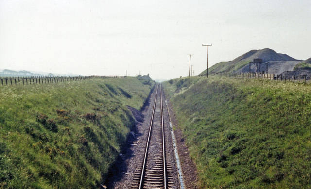
Image: © Ben Brooksbank Taken: 29 Jun 1986
View westward, towards Georgemas Junction and the south: ex-Highland Railway (Far North line), Inverness - Dingwall - Georgemas Junction - Thurso/Wick. The line remains active, but the former station - just visible ahead - was closed from 13/6/60 (goods 18/5/64). Viewpoint is from the road bridge over the railway, and the hill and workings on the right are part of the Bower (stone) Quarry.
Images are licensed for reuse under creativecommons.org/licenses/by-sa/2.0
Image Location


Leaflet Map data © OpenStreetMap
Latitude
58.506932
Longitude
-3.374439