Inside All Saints, Segenhoe
Introduction
The photograph on this page of Inside All Saints, Segenhoe by Rob Farrow as part of the Geograph project.
The Geograph project started in 2005 with the aim of publishing, organising and preserving representative images for every square kilometre of Great Britain, Ireland and the Isle of Man.

There are currently over 7.5m images from over 14,400 individuals and you can help contribute to the project by visiting https://www.geograph.org.uk
Inside All Saints, Segenhoe
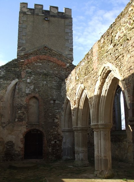
Image: © Rob Farrow Taken: 31 Jan 2007
This view of the interior of the ruined church of Image] is looking roughly westwards* in the direction of the tower. The arcading to the right separates the nave from a northern aisle which formed a side chapel. A view inside the tower can be seen here Image] * Churches usually lie East/West with the tower or spire at the western end and the chancel and altar at the eastern end. However, as with its successor at Ridgmont, this church is oriented about 15º off true such that it lies roughly ENE/WSW. Interestingly this is pretty much the same error as seen at Ridgmont, making the two churches parallel.
Images are licensed for reuse under creativecommons.org/licenses/by-sa/2.0
Image Location
Latitude
52.011786
Longitude
-0.571774