Three Sumps Spring History
Introduction
The photograph on this page of Three Sumps Spring History by MDS as part of the Geograph project.
The Geograph project started in 2005 with the aim of publishing, organising and preserving representative images for every square kilometre of Great Britain, Ireland and the Isle of Man.

There are currently over 7.5m images from over 14,400 individuals and you can help contribute to the project by visiting https://www.geograph.org.uk
Three Sumps Spring History
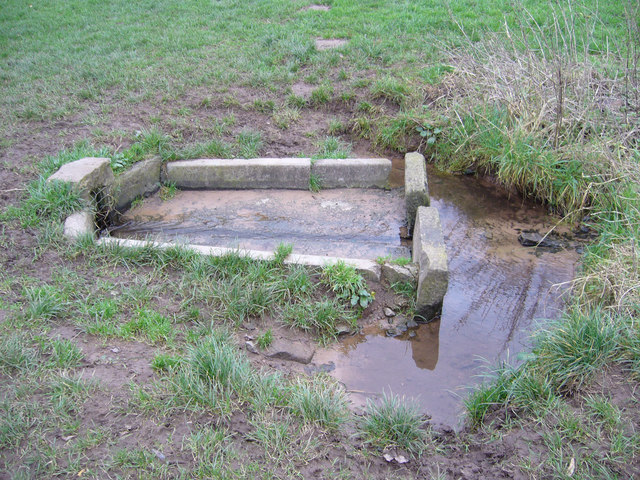
Image: © MDS Taken: 15 Dec 2006
Ancient History, Farming and Engineering works. The central sump of the stream, which is diverted subsurface, north from here, then surface to sump three and subsurface to the Lake Grounds, above Portishead path, showing its Age and spread back to the original inclination seaward to the Cliff. The whole site is awash in wet weather. South is the Hole in One, incised valley, with full stream, to the beach. Sump one is across Nore Road to the east, below Portishead Down, lower north slope. All sandstone, marl and quality soils that used quantities of fertilizer application and produced acres of barley, above the Conglomerate cliff base. I believe this may be an old landslide toward the north west over fragmented rock regolith sloping south, of older Geology, added to by soil slip and forest removal upslope and agricultural history, as well as the many spring seeps, but the base regolith is well drained, so the water is surface retained. Skylark once used this ditch hedgerow, for years as a nest site.
Images are licensed for reuse under creativecommons.org/licenses/by-sa/2.0
Image Location


Leaflet Map data © OpenStreetMap
Latitude
51.487746
Longitude
-2.777825