Norwood Road (3)
Introduction
The photograph on this page of Norwood Road (3) by Stephen Richards as part of the Geograph project.
The Geograph project started in 2005 with the aim of publishing, organising and preserving representative images for every square kilometre of Great Britain, Ireland and the Isle of Man.

There are currently over 7.5m images from over 14,400 individuals and you can help contribute to the project by visiting https://www.geograph.org.uk
Norwood Road (3)
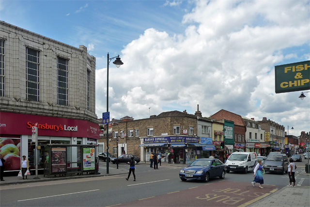
Image: © Stephen Richards Taken: 30 Jul 2012
The west side of the street is much less coherent than the east side (Image] and Image]). The tiled front of Sainsbury's, on the corner of Lansdowne Hill, looks inter-war, the remainder mostly Victorian. The chippie on the right is not as parsimonious as the photo suggests.
Images are licensed for reuse under creativecommons.org/licenses/by-sa/2.0
Image Location
Latitude
51.434359
Longitude
-0.104153