Norwood High Street (1)
Introduction
The photograph on this page of Norwood High Street (1) by Stephen Richards as part of the Geograph project.
The Geograph project started in 2005 with the aim of publishing, organising and preserving representative images for every square kilometre of Great Britain, Ireland and the Isle of Man.

There are currently over 7.5m images from over 14,400 individuals and you can help contribute to the project by visiting https://www.geograph.org.uk
Norwood High Street (1)
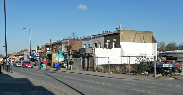
Image: © Stephen Richards Taken: 2 Feb 2012
A tatty stretch on the east side running north from Windsor Grove (far right). The modest mid-Victorian two-storey houses would probably scrub up reasonably well, but sit far back behind a ragbag of projecting shops, several of which are currently empty. The corner site is empty, save for two rusting Volkswagens.
Images are licensed for reuse under creativecommons.org/licenses/by-sa/2.0
Image Location
Latitude
51.429183
Longitude
-0.101059