All Saints, Ridgmont from All Saints, Segenhoe
Introduction
The photograph on this page of All Saints, Ridgmont from All Saints, Segenhoe by Rob Farrow as part of the Geograph project.
The Geograph project started in 2005 with the aim of publishing, organising and preserving representative images for every square kilometre of Great Britain, Ireland and the Isle of Man.

There are currently over 7.5m images from over 14,400 individuals and you can help contribute to the project by visiting https://www.geograph.org.uk
All Saints, Ridgmont from All Saints, Segenhoe
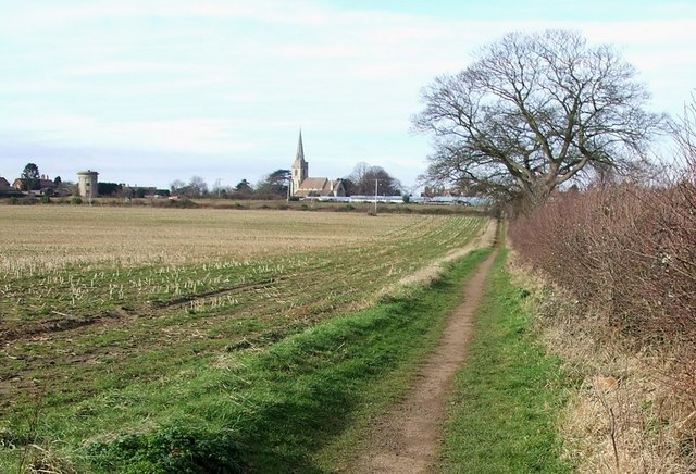
Image: © Rob Farrow Taken: 31 Jan 2007
The footpath seen here leads from the ancient settlement of Segenhoe near to Image] through fields to Ridgmont, where the much newer Image] (&Image]) points its steeple to Heaven. Note also the water tower a little way to the south of the church at SP97633593
Images are licensed for reuse under creativecommons.org/licenses/by-sa/2.0
Image Location
Latitude
52.014304
Longitude
-0.579271