Redevelopment area, Belfast
Introduction
The photograph on this page of Redevelopment area, Belfast by Rossographer as part of the Geograph project.
The Geograph project started in 2005 with the aim of publishing, organising and preserving representative images for every square kilometre of Great Britain, Ireland and the Isle of Man.

There are currently over 7.5m images from over 14,400 individuals and you can help contribute to the project by visiting https://www.geograph.org.uk
Redevelopment area, Belfast
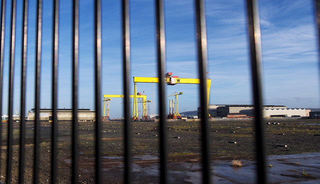
Image: © Rossographer Taken: 16 Dec 2012
Another part of the 'Titanic Quarter' area of Belfast, this is cleared but as yet undeveloped land between the Sydenham Road and Queen's Road. The building dock at Harland and Wolff is in the background. A few years ago it contained a clutter of building materials which have since either been moved or used on other projects Image
Images are licensed for reuse under creativecommons.org/licenses/by-sa/2.0
Image Location
Latitude
54.60345
Longitude
-5.910261