Looking West from A50 Meir tunnel entrance (during construction)
Introduction
The photograph on this page of Looking West from A50 Meir tunnel entrance (during construction) by Chris Beaver as part of the Geograph project.
The Geograph project started in 2005 with the aim of publishing, organising and preserving representative images for every square kilometre of Great Britain, Ireland and the Isle of Man.

There are currently over 7.5m images from over 14,400 individuals and you can help contribute to the project by visiting https://www.geograph.org.uk
Looking West from A50 Meir tunnel entrance (during construction)
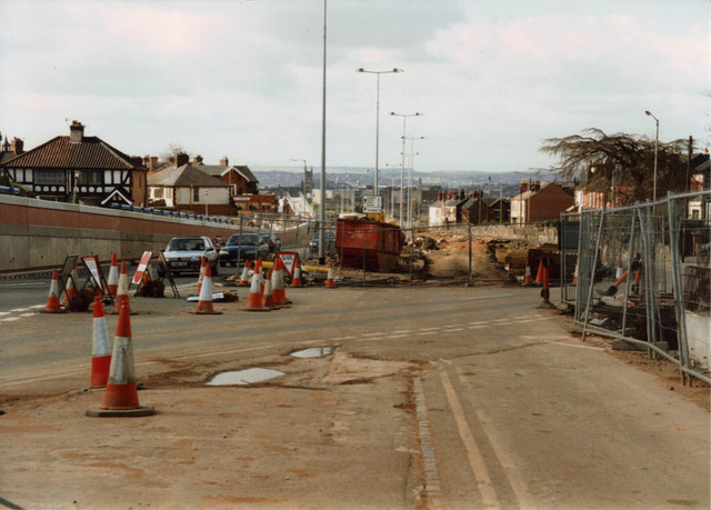
Image: © Chris Beaver Taken: Unknown
Probably taken during 1996, this view west towards Longton shows St James's church in the distance. To the left of that but much closer to the camera is Longton British Legion at the junction of Meir Road and the old Uttoxeter Road. The big new lights are now in the central reservation of the A50 dual carriageway. Looks very different now.
Images are licensed for reuse under creativecommons.org/licenses/by-sa/2.0
Image Location
Latitude
52.979615
Longitude
-2.11017