Signs on the railway bridge, Brearley Lane
Introduction
The photograph on this page of Signs on the railway bridge, Brearley Lane by Humphrey Bolton as part of the Geograph project.
The Geograph project started in 2005 with the aim of publishing, organising and preserving representative images for every square kilometre of Great Britain, Ireland and the Isle of Man.

There are currently over 7.5m images from over 14,400 individuals and you can help contribute to the project by visiting https://www.geograph.org.uk
Signs on the railway bridge, Brearley Lane
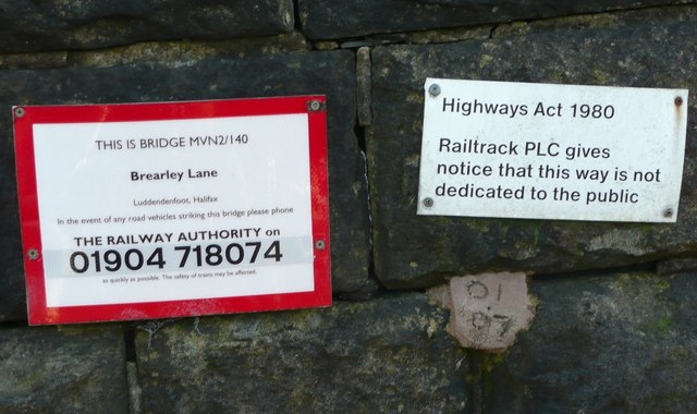
Image: © Humphrey Bolton Taken: 11 Dec 2012
This bridge was constructed to carry the diverted route of Blind Lane, which gave and still does give access to several properties. It is also a public footpath. It does therefore seem strange that Railtrack have stated that the way is not dedicated to the public.
Images are licensed for reuse under creativecommons.org/licenses/by-sa/2.0
Image Location
Latitude
53.728592
Longitude
-1.962071