Nottingham, NG6 - Bulwell
Introduction
The photograph on this page of Nottingham, NG6 - Bulwell by David Hallam-Jones as part of the Geograph project.
The Geograph project started in 2005 with the aim of publishing, organising and preserving representative images for every square kilometre of Great Britain, Ireland and the Isle of Man.

There are currently over 7.5m images from over 14,400 individuals and you can help contribute to the project by visiting https://www.geograph.org.uk
Nottingham, NG6 - Bulwell
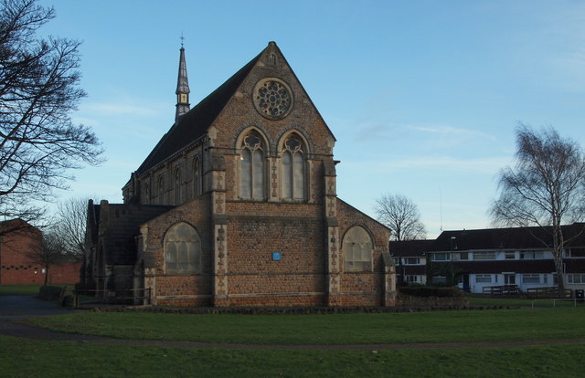
Image: © David Hallam-Jones Taken: 15 Dec 2012
Halfway along Rufford Walk - a pedestrian walkway that links the Blenheim area of Bulwell with the 'non town centre end' of Commercial Road - St John's Anglican Church can be found occupying this grassy area, surrounded by a council housing estate. The houses on the right are on Keys Close whilst the two separate Rufford Junior & Infant Schools are situated immediately on the left, albeit off this picture.
Images are licensed for reuse under creativecommons.org/licenses/by-sa/2.0
Image Location
Latitude
53.003528
Longitude
-1.204951