Midland Bank, Tavistock
Introduction
The photograph on this page of Midland Bank, Tavistock by Derek Harper as part of the Geograph project.
The Geograph project started in 2005 with the aim of publishing, organising and preserving representative images for every square kilometre of Great Britain, Ireland and the Isle of Man.

There are currently over 7.5m images from over 14,400 individuals and you can help contribute to the project by visiting https://www.geograph.org.uk
Midland Bank, Tavistock
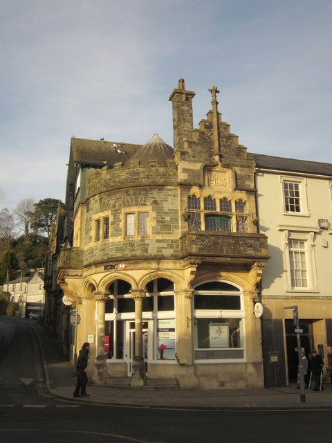
Image: © Derek Harper Taken: 11 Dec 2012
On Bedford Square at the junction of Drake Road (left). "Dated 1895. Originally built as the Constitutional Club" http://list.english-heritage.org.uk/resultsingle.aspx?uid=1105831&searchtype=mapsearch . Some very distinctive features - "enjoyable self-conscious", say Cherry & Pevsner.
Images are licensed for reuse under creativecommons.org/licenses/by-sa/2.0
Image Location
Latitude
50.550219
Longitude
-4.144778