Chapel name plate detail
Introduction
The photograph on this page of Chapel name plate detail by chris whitehouse as part of the Geograph project.
The Geograph project started in 2005 with the aim of publishing, organising and preserving representative images for every square kilometre of Great Britain, Ireland and the Isle of Man.

There are currently over 7.5m images from over 14,400 individuals and you can help contribute to the project by visiting https://www.geograph.org.uk
Chapel name plate detail
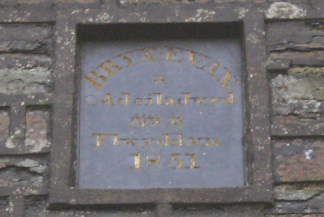
Image: © chris whitehouse Taken: 14 Dec 2012
Little bit blurred but this small name plate could not be read without magnification, Bryn-Evan, a Adeiladwyd, ???? Flwyddyn, 1851.
Images are licensed for reuse under creativecommons.org/licenses/by-sa/2.0
Image Location
Latitude
51.955792
Longitude
-4.451961