Site of the Former Creams Paper Mill
Introduction
The photograph on this page of Site of the Former Creams Paper Mill by David Dixon as part of the Geograph project.
The Geograph project started in 2005 with the aim of publishing, organising and preserving representative images for every square kilometre of Great Britain, Ireland and the Isle of Man.

There are currently over 7.5m images from over 14,400 individuals and you can help contribute to the project by visiting https://www.geograph.org.uk
Site of the Former Creams Paper Mill
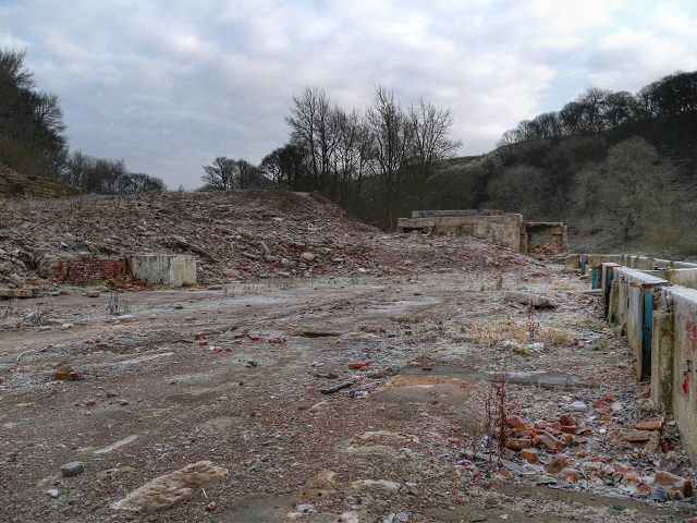
Image: © David Dixon Taken: 12 Dec 2012
Creams paper mill was situated on the bank of the River Irwell, below the Manchester, Bolton and Bury Canal. It is believed that the mill was founded in 1677 and was run for many generations by the Crompton family. It ceased production in December 2004 while being operated by Mondi Paper UK. Rising production costs, mainly a doubling in the price of the gas they used as an energy source, was given as the reason. At the time the mill was producing 63,000 tons of paper products per annum for the corrugated packaging industry. I'm not sure when it was finally demolished, but it was still standing as late as 2009, when Image] was photographed by Tom Jeffs. Image] by Dr Neil Clifton shows a view of the site taken in 1992, when the mill was still in production. http://www.hughespaper.com/creams.html web page about Creams Paper Mill.
Images are licensed for reuse under creativecommons.org/licenses/by-sa/2.0
Image Location
Latitude
53.553479
Longitude
-2.36841