Rowley Burn at Blackhall Mill
Introduction
The photograph on this page of Rowley Burn at Blackhall Mill by Andrew Curtis as part of the Geograph project.
The Geograph project started in 2005 with the aim of publishing, organising and preserving representative images for every square kilometre of Great Britain, Ireland and the Isle of Man.

There are currently over 7.5m images from over 14,400 individuals and you can help contribute to the project by visiting https://www.geograph.org.uk
Rowley Burn at Blackhall Mill
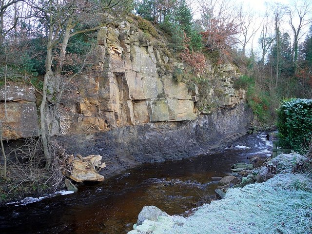
Image: © Andrew Curtis Taken: 30 Nov 2012
The sloping Carboniferous rock strata are said to create the optical illusion of water in the burn flowing uphill. Another photo shows how prone the softer lower rock layers are to being undercut causing rock falls Image
Images are licensed for reuse under creativecommons.org/licenses/by-sa/2.0
Image Location
Latitude
54.922234
Longitude
-2.097014