
Mellor Moor
Introduction
The photograph on this page of Mellor Moor by Rude Health as part of the Geograph project.
The Geograph project started in 2005 with the aim of publishing, organising and preserving representative images for every square kilometre of Great Britain, Ireland and the Isle of Man.

There are currently over 7.5m images from over 14,400 individuals and you can help contribute to the project by visiting https://www.geograph.org.uk
Mellor Moor
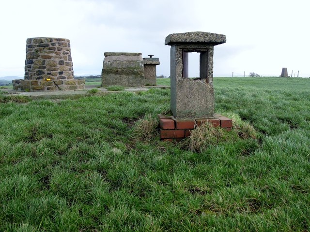
Image: © Rude Health Taken: 23 Jan 2012
Mellor Moor 223 metres high, a P75 hill with a trig point plus is the site of a Roman signalling station and a now-disused Royal Observer Corps Nuclear Blast and Fallout Monitoring Station. The monitoring post was opened in July 1959, was decommissioned in October 1968 and is situated on a low mound ten yards west of a trig point overlooking BAE Samlesbury Airfield. Many people still believe that this was a nuclear shelter or an air raid shelter for the use of the local population during times of war. A millennium viewpoint pillar has been erected alongside encroaching onto the top of the post.
Images are licensed for reuse under creativecommons.org/licenses/by-sa/2.0
Image Location

Latitude
53.776808
Longitude
-2.521348