Site of Nantgarw Halt
Introduction
The photograph on this page of Site of Nantgarw Halt by John Light as part of the Geograph project.
The Geograph project started in 2005 with the aim of publishing, organising and preserving representative images for every square kilometre of Great Britain, Ireland and the Isle of Man.

There are currently over 7.5m images from over 14,400 individuals and you can help contribute to the project by visiting https://www.geograph.org.uk
Site of Nantgarw Halt
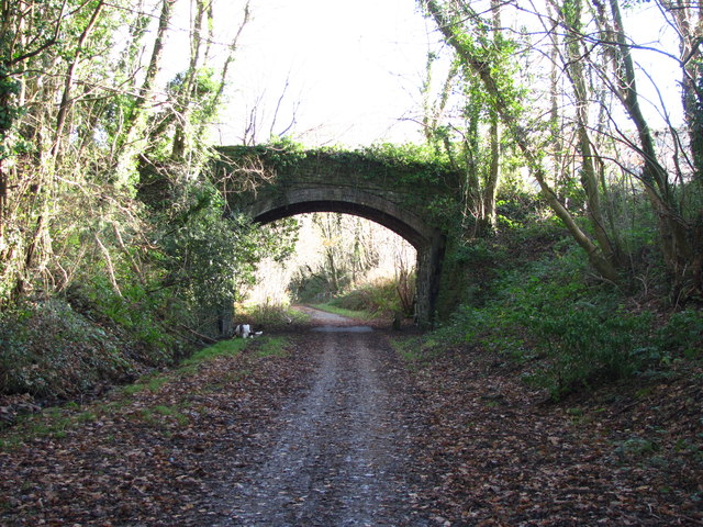
Image: © John Light Taken: 1 Dec 2012
Part of the Pontypridd,Caerphilly and Newport Railway. The line closed to passengers in September 1956. There was no platform - just a wooden waiting shelter. You can't see it in this shot, but it is possible to trace the path leading down from the bridge to the site of the halt. Nowadays the line is used as part of the Celtic Trail/Taff Trail.
Images are licensed for reuse under creativecommons.org/licenses/by-sa/2.0
Image Location
Latitude
51.564079
Longitude
-3.26416