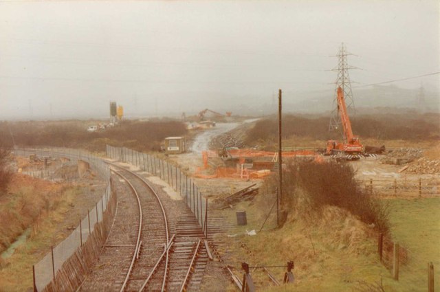
St Dennis Junction
Introduction
The photograph on this page of St Dennis Junction by John Winder as part of the Geograph project.
The Geograph project started in 2005 with the aim of publishing, organising and preserving representative images for every square kilometre of Great Britain, Ireland and the Isle of Man.
There are currently over 7.5m images from over 14,400 individuals and you can help contribute to the project by visiting https://www.geograph.org.uk

Image: © John Winder Taken: Unknown
Taken sometime in the 1990s, 1995 I think. This was taken from the old A30 overbridge at the site of St Dennis Junction on the Newquay to Par line. At this stage, the junction had all but disappeared and the points and headshunt in the foreground were about all that remained. In the background work is just about underway on what will become the new A30 bridge. 1995 is a bit of a guess for the date of this one, if anyone can date it more accurately then please do! An alternative view, showing the bridge I was standing on, is in Roger geach's photo at http://www.geograph.org.uk/photo/1971807

