Shute Barton
Introduction
The photograph on this page of Shute Barton by Derek Harper as part of the Geograph project.
The Geograph project started in 2005 with the aim of publishing, organising and preserving representative images for every square kilometre of Great Britain, Ireland and the Isle of Man.

There are currently over 7.5m images from over 14,400 individuals and you can help contribute to the project by visiting https://www.geograph.org.uk
Shute Barton
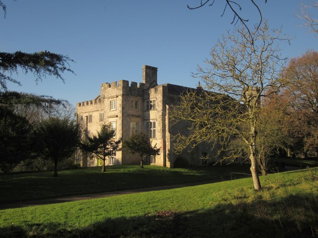
Image: © Derek Harper Taken: 5 Dec 2012
Also shown in http://www.geograph.org.uk/search.php?i=38538957 . This view is from a path leading from the churchyard. This is what remains of the medieval manor house. "The square tower on the south east side of the southeast wing is probably part of the late C15 additions, although the windows are C16 and C17" http://list.english-heritage.org.uk/resultsingle.aspx?uid=1171033&searchtype=mapsearch .
Images are licensed for reuse under creativecommons.org/licenses/by-sa/2.0
Image Location
Latitude
50.771438
Longitude
-3.061424