Old Church House, Colyton
Introduction
The photograph on this page of Old Church House, Colyton by Derek Harper as part of the Geograph project.
The Geograph project started in 2005 with the aim of publishing, organising and preserving representative images for every square kilometre of Great Britain, Ireland and the Isle of Man.

There are currently over 7.5m images from over 14,400 individuals and you can help contribute to the project by visiting https://www.geograph.org.uk
Old Church House, Colyton
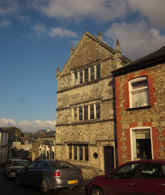
Image: © Derek Harper Taken: 5 Dec 2012
"Not the usual type of church house", observe Cherry & Pevsner. Dated 1612, it stands at the northern end of the Market Place and is described at http://list.english-heritage.org.uk/resultsingle.aspx?uid=1098527&searchtype=mapsearch . Colyton Grammar School used to occupy the building.
Images are licensed for reuse under creativecommons.org/licenses/by-sa/2.0
Image Location


Leaflet Map data © OpenStreetMap
Latitude
50.74096
Longitude
-3.070372