The Dry Arch
Introduction
The photograph on this page of The Dry Arch by Derek Hawkins as part of the Geograph project.
The Geograph project started in 2005 with the aim of publishing, organising and preserving representative images for every square kilometre of Great Britain, Ireland and the Isle of Man.

There are currently over 7.5m images from over 14,400 individuals and you can help contribute to the project by visiting https://www.geograph.org.uk
The Dry Arch
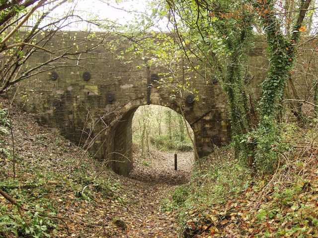
Image: © Derek Hawkins Taken: 11 Apr 2006
This arch is on the A363 and was built around 1795 when this new road was opened. The arch was built over the track that runs from Warleigh to Monkton Farleigh. Bathford is unusual as it has two dry arches one either end of the parish boundary.
Images are licensed for reuse under creativecommons.org/licenses/by-sa/2.0
Image Location
Latitude
51.377839
Longitude
-2.291617