Rawtenstall West Level Crossing
Introduction
The photograph on this page of Rawtenstall West Level Crossing by Paul Anderson as part of the Geograph project.
The Geograph project started in 2005 with the aim of publishing, organising and preserving representative images for every square kilometre of Great Britain, Ireland and the Isle of Man.

There are currently over 7.5m images from over 14,400 individuals and you can help contribute to the project by visiting https://www.geograph.org.uk
Rawtenstall West Level Crossing
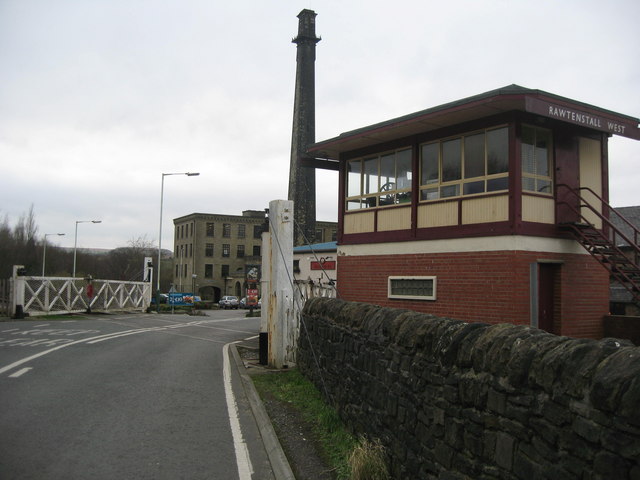
Image: © Paul Anderson Taken: 30 Jan 2007
This level crossing is part of the East Lancs Railway http://web.archive.org/web/20080318121242/http://east-lancs-rly.co.uk/?p=history&m=43 that runs from Heywood via Bury to Rawtenstall. The mill in the background is Hardman Mill built in 1862 by the Hardman family. It is now a business centre. Image
Images are licensed for reuse under creativecommons.org/licenses/by-sa/2.0
Image Location
Latitude
53.696324
Longitude
-2.296202