Ramada - Hatfield
Introduction
The photograph on this page of Ramada - Hatfield by Fernweh as part of the Geograph project.
The Geograph project started in 2005 with the aim of publishing, organising and preserving representative images for every square kilometre of Great Britain, Ireland and the Isle of Man.

There are currently over 7.5m images from over 14,400 individuals and you can help contribute to the project by visiting https://www.geograph.org.uk
Ramada - Hatfield
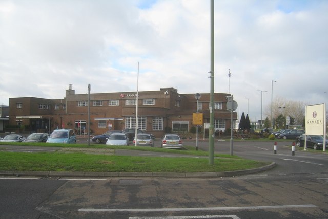
Image: © Fernweh Taken: 1 Dec 2012
An interesting building. Built in 1933 as the 'Comet' public house adjacent to the new line of the A1 skirting Hatfield as the 'Barnet Bypass', it is a typical 1930s 'Road House'. It is Grade II listed - see http://list.historicengland.org.uk/resultsingle.aspx?uid=1101036. Just out of sight of the camera in this shot is a model of the original De Havilland Comet aircraft, developed at the adjacent airfield. See Image and Image for pictures.
Images are licensed for reuse under creativecommons.org/licenses/by-sa/2.0
Image Location
Latitude
51.760261
Longitude
-0.244132