Site of the Drumclay Crannog, Enniskillen
Introduction
The photograph on this page of Site of the Drumclay Crannog, Enniskillen by Kenneth Allen as part of the Geograph project.
The Geograph project started in 2005 with the aim of publishing, organising and preserving representative images for every square kilometre of Great Britain, Ireland and the Isle of Man.

There are currently over 7.5m images from over 14,400 individuals and you can help contribute to the project by visiting https://www.geograph.org.uk
Site of the Drumclay Crannog, Enniskillen
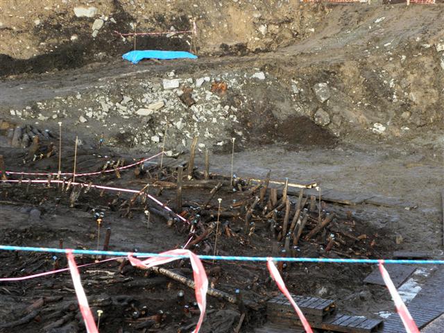
Image: © Kenneth Allen Taken: 1 Dec 2012
This site contained between 10 or more small wattle dwellings, occupied at various stages. Strange to think that this area was once surrounded by water and people could live there, but conditions would have been basic. Some of the general public visiting the site brought their Wellies, but it was deemed too hazardous to go down into the dig. Occasional flooding and vandalism has been a problem at times. The plan is to go down to a depth of five metres and the archaeologists have two more to go. You haven't to go too far to see more of them Image]
Images are licensed for reuse under creativecommons.org/licenses/by-sa/2.0
Image Location
Latitude
54.35553
Longitude
-7.620697