End of a ferry
Introduction
The photograph on this page of End of a ferry by Marathon as part of the Geograph project.
The Geograph project started in 2005 with the aim of publishing, organising and preserving representative images for every square kilometre of Great Britain, Ireland and the Isle of Man.

There are currently over 7.5m images from over 14,400 individuals and you can help contribute to the project by visiting https://www.geograph.org.uk
End of a ferry
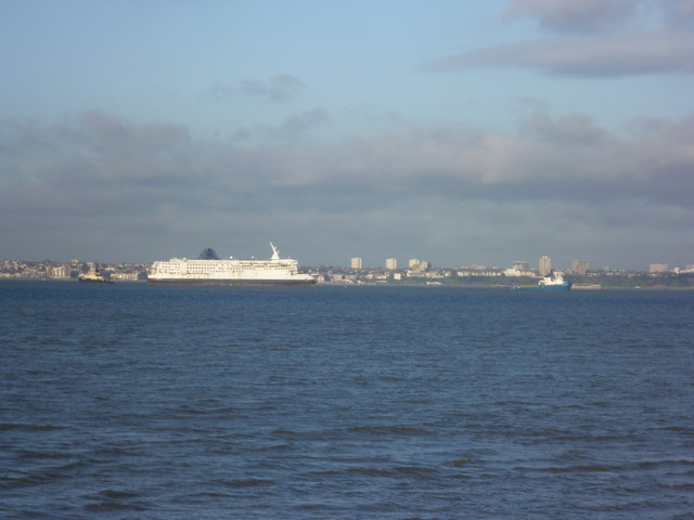
Image: © Marathon Taken: 29 Nov 2012
This view looks across the Thames from Allhallows-on-Sea to Westcliff-on-Sea. Between the two is the Pride of Dover on its final trip from Tilbury Docks to be broken up in Turkey. The former Dover to Calais ferry had been laid up in Tilbury for two years hoping for a buyer, but none materialised. The trip would take four weeks and would be pulled the whole way by the tug at the front. The Port of London Authority tug at the back would be shortly detached. For more information on the Pride of Dover and its fate see http://en.wikipedia.org/wiki/MS_Pride_of_Dover
Images are licensed for reuse under creativecommons.org/licenses/by-sa/2.0
Image Location
Latitude
51.535797
Longitude
0.687395