Site of Audlem station, 1990
Introduction
The photograph on this page of Site of Audlem station, 1990 by Ben Brooksbank as part of the Geograph project.
The Geograph project started in 2005 with the aim of publishing, organising and preserving representative images for every square kilometre of Great Britain, Ireland and the Isle of Man.

There are currently over 7.5m images from over 14,400 individuals and you can help contribute to the project by visiting https://www.geograph.org.uk
Site of Audlem station, 1990
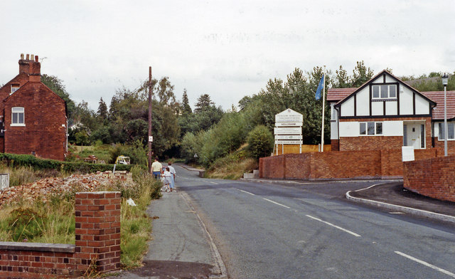
Image: © Ben Brooksbank Taken: 27 Aug 1990
View eastward on the A529 road, where the ex-GWR (Crewe) - Nantwich (to left) - Market Drayton (to right) - Wellington secondary main line used to cross. The station, which was on the right, was closed to passengers from 9/9/63 (with the Crewe - Wellington passenger service) and to goods from 2/2/64, but the Nantwich - Wellington line - always important for freight, survived until 8/5/67.
Images are licensed for reuse under creativecommons.org/licenses/by-sa/2.0
Image Location
Latitude
52.983752
Longitude
-2.517555