Path beside Hangman's Wood, Little Thurrock
Introduction
The photograph on this page of Path beside Hangman's Wood, Little Thurrock by David Anstiss as part of the Geograph project.
The Geograph project started in 2005 with the aim of publishing, organising and preserving representative images for every square kilometre of Great Britain, Ireland and the Isle of Man.

There are currently over 7.5m images from over 14,400 individuals and you can help contribute to the project by visiting https://www.geograph.org.uk
Path beside Hangman's Wood, Little Thurrock
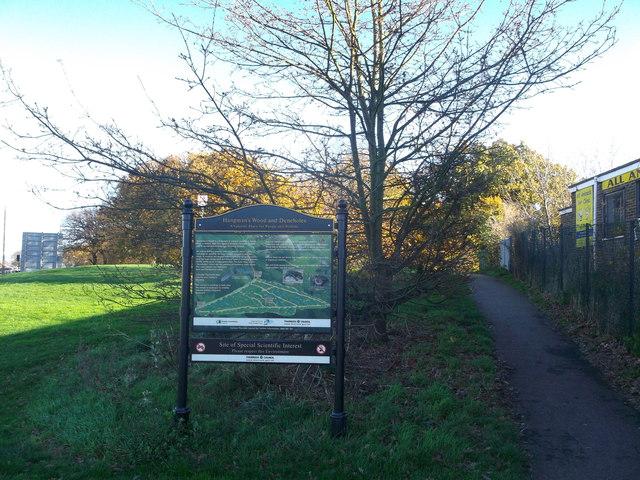
Image: © David Anstiss Taken: 25 Nov 2012
This path is part of a bridleway leading from Little Thurrock towards Chadwell St Mary. In the wood on the left, are deneholes. Which are underground structures consisting of a number of small chalk caves entered by a vertical shaft. Constructed by the Danes. The sign gives a history of the site.
Images are licensed for reuse under creativecommons.org/licenses/by-sa/2.0
Image Location


Leaflet Map data © OpenStreetMap
Latitude
51.489183
Longitude
0.345106