Path to Burnbrae
Introduction
The photograph on this page of Path to Burnbrae by Lairich Rig as part of the Geograph project.
The Geograph project started in 2005 with the aim of publishing, organising and preserving representative images for every square kilometre of Great Britain, Ireland and the Isle of Man.

There are currently over 7.5m images from over 14,400 individuals and you can help contribute to the project by visiting https://www.geograph.org.uk
Path to Burnbrae
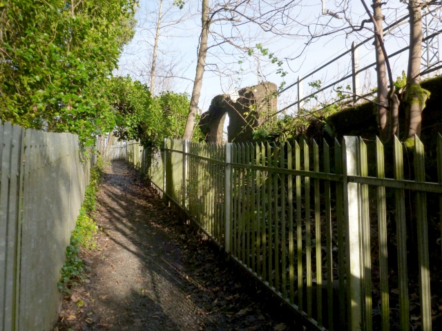
Image: © Lairich Rig Taken: 21 Nov 2012
On the right, between the path and the railway line, is an Image (see also Image), presumably associated with the Millburn Pyroligneous Works; the works stood on what is now the site of Image From the part of the path beside the arch, there can be seen to the left of the path a remnant of the wall of a building: Image For the same path, viewed from a little further ahead, see Image
Images are licensed for reuse under creativecommons.org/licenses/by-sa/2.0
Image Location
Latitude
55.977437
Longitude
-4.586273