8 and 8A Kirk Road (Carmunnock Heritage Trail)
Introduction
The photograph on this page of 8 and 8A Kirk Road (Carmunnock Heritage Trail) by G Laird as part of the Geograph project.
The Geograph project started in 2005 with the aim of publishing, organising and preserving representative images for every square kilometre of Great Britain, Ireland and the Isle of Man.

There are currently over 7.5m images from over 14,400 individuals and you can help contribute to the project by visiting https://www.geograph.org.uk
8 and 8A Kirk Road (Carmunnock Heritage Trail)
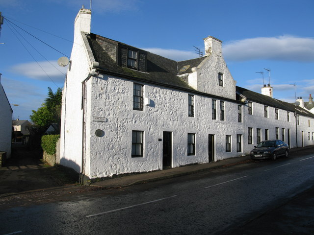
Image: © G Laird Taken: 28 Nov 2012
This 18th century tenement, with its nepus gable, is said to rest on 14th century foundations. From early times, detachments of soldiers were sometimes billeted here. The building which contained a shop until the 1940s, was refurbished in 1984.
Images are licensed for reuse under creativecommons.org/licenses/by-sa/2.0
Image Location
Latitude
55.79115
Longitude
-4.236188