Scwfra, Dukestown, Tredegar
Introduction
The photograph on this page of Scwfra, Dukestown, Tredegar by Robin Drayton as part of the Geograph project.
The Geograph project started in 2005 with the aim of publishing, organising and preserving representative images for every square kilometre of Great Britain, Ireland and the Isle of Man.

There are currently over 7.5m images from over 14,400 individuals and you can help contribute to the project by visiting https://www.geograph.org.uk
Scwfra, Dukestown, Tredegar
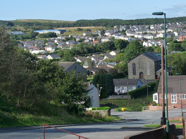
Image: © Robin Drayton Taken: 13 Sep 2012
This view is looking towards the west. The chapels are Carmel Welsh Baptist on the right and Ebenezer Independent to the left. Scwfra means scouring, referring to an early method of getting at mineral deposits by releasing a flood of water to wash away the soil. Here, the mineral deposits were iron ore. The following is an extract from A History of Monmouthshire, Vol 5, by Sir J A Bradney, published by the South Wales Record Society. The full document can be accessed via http://welshjournals.llgc.org.uk/ . The oldest process was to scratch on the surface for the mineral but as the mineral got deeper in the earth it was necessary to drive several holes with a bar till a large piece of stratum would fall. A pond would be constructed so that the dam could be cut through and the water allowed to rush over the material separating the mine from the rubbish. This was called scouring, in Welsh ysgwrio, which word survives in the place name Scwrfa.
Images are licensed for reuse under creativecommons.org/licenses/by-sa/2.0
Image Location
Latitude
51.784658
Longitude
-3.246107