Sandhills (Fitzgeorge Street Gates)
Introduction
The photograph on this page of Sandhills (Fitzgeorge Street Gates) by David Dixon as part of the Geograph project.
The Geograph project started in 2005 with the aim of publishing, organising and preserving representative images for every square kilometre of Great Britain, Ireland and the Isle of Man.

There are currently over 7.5m images from over 14,400 individuals and you can help contribute to the project by visiting https://www.geograph.org.uk
Sandhills (Fitzgeorge Street Gates)
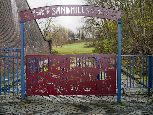
Image: © David Dixon Taken: 27 Nov 2012
Much of the red sandstone used for building in Manchester and the surrounding area, came from Collyhurst Quarry. The stone was transported the short distance into Manchester via the nearby River Irk on barges or rafts. The quarry is now disused and the area around it has been turned into a park called "Sandhills" http://www.irkvalley.info/sites/sandhills/siteinfo.html as part of Manchester City Council's Irk Valley Project http://www.manchester.gov.uk/site/scripts/services_info.php?serviceID=2172 . This view shows the entrance under the former railway arch at Fitzgeorge Street. The arch is part of the nineteenth century viaduct built originally for the railway, now used by the Metrolink tramway.
Images are licensed for reuse under creativecommons.org/licenses/by-sa/2.0
Image Location
Latitude
53.496757
Longitude
-2.226373