Remnants of the Alexandria Works
Introduction
The photograph on this page of Remnants of the Alexandria Works by Lairich Rig as part of the Geograph project.
The Geograph project started in 2005 with the aim of publishing, organising and preserving representative images for every square kilometre of Great Britain, Ireland and the Isle of Man.

There are currently over 7.5m images from over 14,400 individuals and you can help contribute to the project by visiting https://www.geograph.org.uk
Remnants of the Alexandria Works
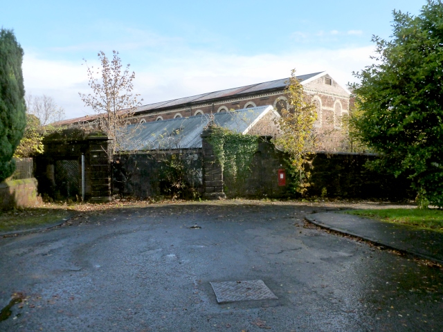
Image: © Lairich Rig Taken: 2 Nov 2012
The first-edition OS map (surveyed in 1860) shows the Croftengea Print Works in this general area, although the large buildings shown here were not yet present. These works later merged with the Levenfield Works, which were just to the north, to form the Alexandria Works. The equivalent OS map surveyed c.1897 shows this site as "Alexandria Works (Printing and Dyeing)", and the buildings shown in this view were then present. Because of the surrounding wall, they cannot be seen very well other than from a distance, as in a view of Image For another view of the blocked-up old entrance in front of the buildings, see Image The present picture was taken from near the southern end of Image (Image).
Images are licensed for reuse under creativecommons.org/licenses/by-sa/2.0
Image Location
Latitude
55.98942
Longitude
-4.57633