
North from Moor How
Introduction
The photograph on this page of North from Moor How by Karl and Ali as part of the Geograph project.
The Geograph project started in 2005 with the aim of publishing, organising and preserving representative images for every square kilometre of Great Britain, Ireland and the Isle of Man.

There are currently over 7.5m images from over 14,400 individuals and you can help contribute to the project by visiting https://www.geograph.org.uk
North from Moor How
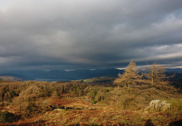
Image: © Karl and Ali Taken: 25 Nov 2012
Moor How is a small enclave of CRoW access land above the southern reaches of Windermere. It can be reached from Birks Road to the north. It is quite a rugged little hill, covered in small Siliurian siltstone outcrops and bracken and grazed by cattle (much evidence underfoot on my visit!). A few larch trees manage to cling on in this exposed location. Unfortunately, the very highest point is out of bounds just over the wall to the south. The mountains at the head of Windermere (just visible) are scraping the clouds.
Images are licensed for reuse under creativecommons.org/licenses/by-sa/2.0
Image Location

Latitude
54.311835
Longitude
-2.927114