Piccadilly Line bridges
Introduction
The photograph on this page of Piccadilly Line bridges by Robin Webster as part of the Geograph project.
The Geograph project started in 2005 with the aim of publishing, organising and preserving representative images for every square kilometre of Great Britain, Ireland and the Isle of Man.

There are currently over 7.5m images from over 14,400 individuals and you can help contribute to the project by visiting https://www.geograph.org.uk
Piccadilly Line bridges
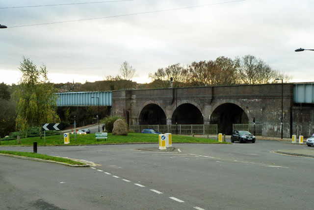
Image: © Robin Webster Taken: 25 Nov 2012
Two plate girder skew bridges over roads and a short length of brick viaduct start the lengthy crossing of the valley of Pymme's Brook, most of which is crossed by a notable brick viaduct off to the left. These date from the early 1930s when the line was extended north of Finsbury Park.
Images are licensed for reuse under creativecommons.org/licenses/by-sa/2.0
Image Location
Latitude
51.621908
Longitude
-0.135641