Light Railway Crossover
Introduction
The photograph on this page of Light Railway Crossover by Des Blenkinsopp as part of the Geograph project.
The Geograph project started in 2005 with the aim of publishing, organising and preserving representative images for every square kilometre of Great Britain, Ireland and the Isle of Man.

There are currently over 7.5m images from over 14,400 individuals and you can help contribute to the project by visiting https://www.geograph.org.uk
Light Railway Crossover
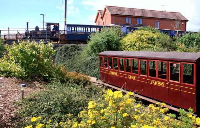
Image: © Des Blenkinsopp Taken: 26 Aug 2012
The Gartell Light Railway runs mainly along a former line closed in the 1960s, but the engine sheds etc. are a short distance away from that alignment. To get onto the main line from the yard, trains make a tight turn under this bridge and up an incline on the other side of the embankment. This means you can get two trains one above the other as shown here.
Images are licensed for reuse under creativecommons.org/licenses/by-sa/2.0
Image Location
Latitude
50.994534
Longitude
-2.404482