Former site of drinking fountain
Introduction
The photograph on this page of Former site of drinking fountain by Lairich Rig as part of the Geograph project.
The Geograph project started in 2005 with the aim of publishing, organising and preserving representative images for every square kilometre of Great Britain, Ireland and the Isle of Man.

There are currently over 7.5m images from over 14,400 individuals and you can help contribute to the project by visiting https://www.geograph.org.uk
Former site of drinking fountain
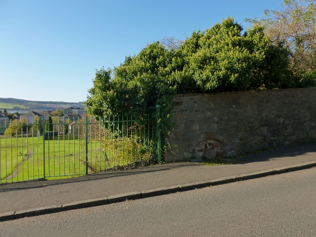
Image: © Lairich Rig Taken: 26 Oct 2012
The road is shown in Image In the background of that picture, there is a green fence to the left of the road. The area shown here is at the far end of that fence. OS maps from c.1970 show a drinking fountain here (marked "D Fn"). It is now gone, but its former site is the semicircular area at the foot of the wall. The year of construction, 1937, can still be read on it; for a closer look, see Image The carved stonework at the entrance of Image, only a short distance down the road, is probably from the same period: Image and Image
Images are licensed for reuse under creativecommons.org/licenses/by-sa/2.0
Image Location
Latitude
55.937867
Longitude
-4.517978