Beechwood Avenue bridge
Introduction
The photograph on this page of Beechwood Avenue bridge by E Gammie as part of the Geograph project.
The Geograph project started in 2005 with the aim of publishing, organising and preserving representative images for every square kilometre of Great Britain, Ireland and the Isle of Man.

There are currently over 7.5m images from over 14,400 individuals and you can help contribute to the project by visiting https://www.geograph.org.uk
Beechwood Avenue bridge
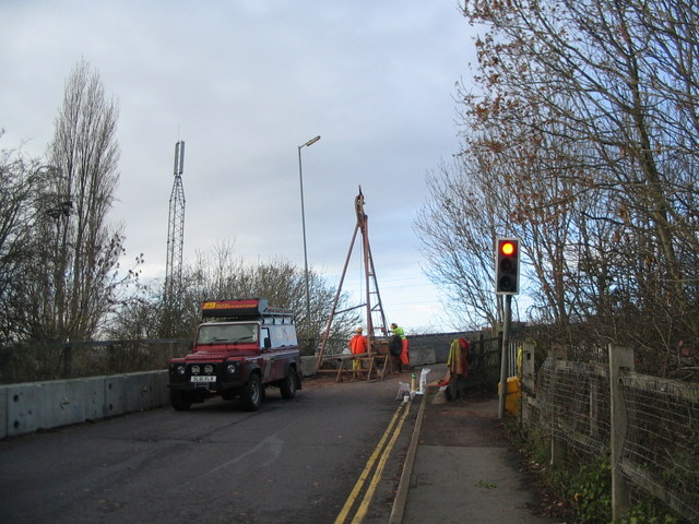
Image: © E Gammie Taken: 25 Nov 2012
Beechwood Avenue bridge, closed for the weekend whilst investigatory drilling work is carried out. I suspect they may find a railway nearby. The approaches to the bridge are at an angle and embanked and the road, comparatively recently resurfaced, suffers from surface cracking. The bridge parapet behind where the drill is located was rebuilt two years ago and concrete barriers added at the western side of the road on both sides of the bridge. The bridge itself is a traffic-light controlled single carriageway and limited to 7.5 tons, although a bus route does cross it. Later work: http://www.geograph.org.uk/photo/3317193 (2013)
Images are licensed for reuse under creativecommons.org/licenses/by-sa/2.0
Image Location
Latitude
52.400383
Longitude
-1.541096