Galmpton
Introduction
The photograph on this page of Galmpton by Derek Harper as part of the Geograph project.
The Geograph project started in 2005 with the aim of publishing, organising and preserving representative images for every square kilometre of Great Britain, Ireland and the Isle of Man.

There are currently over 7.5m images from over 14,400 individuals and you can help contribute to the project by visiting https://www.geograph.org.uk
Galmpton
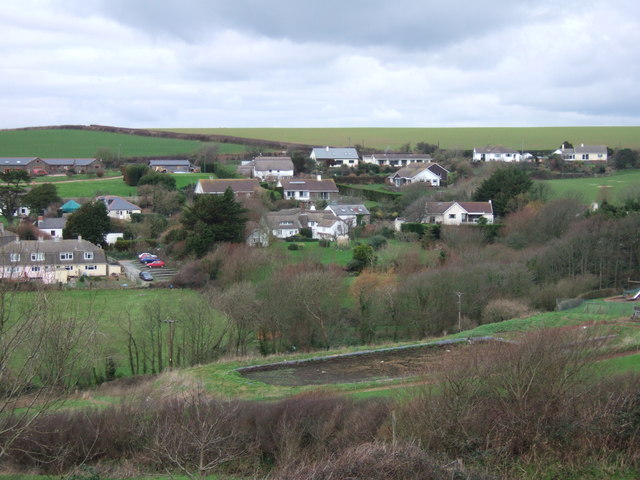
Image: © Derek Harper Taken: 27 Jan 2007
The core of the village, seen from South Huish Footpath 4 as it descends from the ridge separating the valley from the Bolberry valley. Thatched cottages and farms are now surrounded by bungalows and other modern dwellings. In the foreground is an empty midden at Burton Farm.
Images are licensed for reuse under creativecommons.org/licenses/by-sa/2.0
Image Location


Leaflet Map data © OpenStreetMap
Latitude
50.248174
Longitude
-3.835919