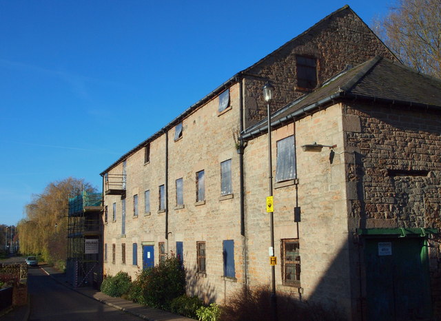
Nottingham, NG6 - Mill Lane
Introduction
The photograph on this page of Nottingham, NG6 - Mill Lane by David Hallam-Jones as part of the Geograph project.
The Geograph project started in 2005 with the aim of publishing, organising and preserving representative images for every square kilometre of Great Britain, Ireland and the Isle of Man.
There are currently over 7.5m images from over 14,400 individuals and you can help contribute to the project by visiting https://www.geograph.org.uk

Image: © David Hallam-Jones Taken: 17 Nov 2012
Early November 2012 saw the completion of a sales contract that is intended to underpin the development of this former mill in Mill Lane, Bestwood. This marks the end of its fourth generation of family ownership since Bayles & Wylie are now operating exclusively out of modern industrial premises in Calverton. Forge Mill was the last piece of property owned by the company in Bestwood, most of the surrounding mill land having already been sold off for new homes in the vicinity referred to as Millbank Place. This Grade II-listed building straddling the River Leen overlooks a mill pond at the rear. It was built as a cotton mill by the Robinson family - c.1783 - on the same premises as an existing iron foundry. For the time being(?) a public footpath at the rear of the mill is no longer accessible. Whilst the new owners have consent to convert the upper floors into 11 apartments, it has been reported that "a deal has been done with a charity who will use the grounds and the first floor for textile-based employment purposes".

