Bench mark at end of Glenfield Road
Introduction
The photograph on this page of Bench mark at end of Glenfield Road by Lairich Rig as part of the Geograph project.
The Geograph project started in 2005 with the aim of publishing, organising and preserving representative images for every square kilometre of Great Britain, Ireland and the Isle of Man.

There are currently over 7.5m images from over 14,400 individuals and you can help contribute to the project by visiting https://www.geograph.org.uk
Bench mark at end of Glenfield Road
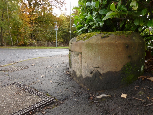
Image: © Lairich Rig Taken: 24 Oct 2012
This picture was taken at the junction where Glenfield Road (background, left) meets the main road (Caplethill Road). According to OS records, this third-order bench mark, a cut mark, is 0.3 metres above ground level, and 61.9329 metres above Newlyn datum. As usual, I wasn't particularly looking out for any such marks, but just happened to notice it when passing.
Images are licensed for reuse under creativecommons.org/licenses/by-sa/2.0
Image Location
Latitude
55.819519
Longitude
-4.422838