Home Truths On the A264
Introduction
The photograph on this page of Home Truths On the A264 by Glyn Baker as part of the Geograph project.
The Geograph project started in 2005 with the aim of publishing, organising and preserving representative images for every square kilometre of Great Britain, Ireland and the Isle of Man.

There are currently over 7.5m images from over 14,400 individuals and you can help contribute to the project by visiting https://www.geograph.org.uk
Home Truths On the A264
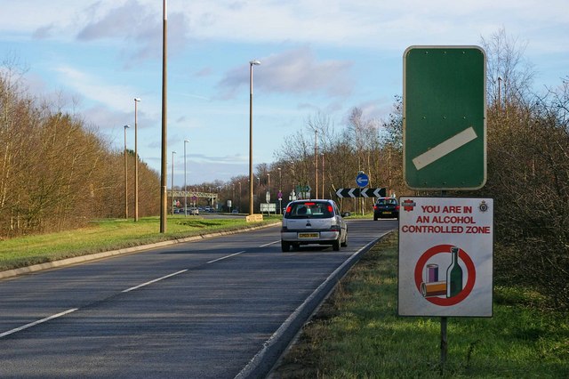
Image: © Glyn Baker Taken: 28 Jan 2007
This is a view of the A264 approach to the A2220 Brewbush roundabout on the outskirts of Crawley. Someone in the Local council either has a sense of humour or needs some English lessons! The sign describes perfectly down-town Crawley on Friday and Saturday nights. The words actually say exactly the opposite of what I assume was the intent. Clearly they mean an “Alcohol Control Zone” rather than a warning to travellers to beware of drunks, or do they?
Images are licensed for reuse under creativecommons.org/licenses/by-sa/2.0
Image Location
Latitude
51.097999
Longitude
-0.228634